| HOME | COMMUNITY | ACTIVITIES | HISTORY | AIRPORT |
MAORI
The Lindis River was an important source of mahika kai for Maori on the inland route that led from the Waitaki River over the Lindis Pass to Lakes Hawea and Wanaka.
The usual route is noted as following Longslip Creek from the Ahuriri River, down the Pass Burn to the Lindis River and then over Mount Grandview to Lake Hawea and the mountain passes beyond which lead to the West Coast settlements.The river contains tuna (long-fin eel), a recognised taoka species for Kāi Tahu that forms a key component of their tribal identity.
When William Rees bought the first flock of sheep over what would later be called 'Thomsons Pass', he followed an established Maori trail. It is likely that this was a 'back up' route used when the Clutha was in flood and the Gorge became impassable.
The gold miners of Bendigo Gully reported in 1872 that they had found pounamu weapons and implements in the stream bed of Bendigo Creek as they mined, local farmers reported finding evidence of broken moa eggs in areas that would suggest possible temporary campsites.
The most significant find of Maori origin in the Bendigo area was the paddle found by two young men, searching techniques in a cave at the back of what is now Bendigo township. "After crawling some distance through the narrow aperture, the cavern suddenly widened out to a good size, and standing against the side they found a Maori paddle. It is neatly finished, is in an excellent state of preservation, and appears to be made of kauri pine." The finder of the paddle was Mr John Evan, who gave it to Vincent Pyke who then donated it to the Otago Museum, which recorded its acquisition in 1877.
EUROPEAN
Tarras was named by Scottish born John Turnbull Thomson when he came through this area in 1857. Thomson was the first Chief
Surveyor for Otago and later the Surveyor- General of NZ. He was responsible for many of our present day place names eg the rivers (Lindis), creeks (Cluden, Timburn and Tarras) and mountains (Dunstan and Pisa).
The creek he named Tarras in those times started on the South side of Lindis Peaks, flowed down through Malvern Downs then on in front of the present Tarras Sore meandering down through Maryland and Tomic, through Davidson's then into the Lindis River. The creek reminded Thomson of Tarras Waters after a moorland near Langholm in Dumfriesshire, Scotland.
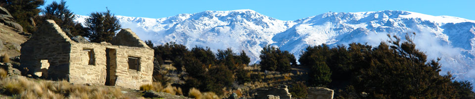
(Thanks to Bill Gibson for this information)The Lindis area was the site of the first gold rush in Otago when gold was found in the Lindis River in 1857. Road builders rediscovered gold in 1861, and about 300 gold-miners flocked to the area. Although the remoteness of the area, the cost of supplies and the opening of more lucrative fields meant most miners left the district a few months later, a number of historic sites, buildings and artefacts remain today throughout the catchment as testimony to the area's mining heritage.
The Lindis Pass is also the site of the release of the first red deer (Cervus elaphus scoticus) in Otago. The herd flourished due to a lack of predators and competition. These deer, now the only remaining pure British red deer in the world, are widespread, but are under threat from interbreeding with escapee farm deer. Various heritage sites are scheduled in the Central Otago District Plan, including the historic buildings in Morven Hills, the Cob Stables at Rocky Point and the ruins of the Lindis Pass Hotel.Gold was discovered at Bendigo Creek in 1862. The goldfield around the settlement became one of the country's richest, yielding an estimated 15 to 50 ounces of gold per week. The initial alluvial gold was rapidly played out, but quartz reefs bearing the precious metal were discovered by Thomas Logan in 1863 and many mine shafts were sunk into the rock during the 1860s. By the mid 1870s, the reef was considered Otago's (and the country's) richest. Mining continued in the area until the 1940s.
The settlement's name is a relic of this time, having been transplanted from the Australian town of the same name by gold miners who had travelled from the Victorian goldfields.
The remains of the gold field, which was rapidly played out, have been largely preserved, and form the basis of the 1085 hectare Bendigo Historic Reserve. The reserve contains numerous walkways and includes the remains of mineshafts, water races, stamping batteries and the remains of several now-deserted settlement buildings.
VIDEO STORIES
click on the image to watch youtube video
ARDGOUR - Allan Jolly
MERIVALE - Gerald Goodger
MORVEN HILLS - Richard Snow
MORVEN HILLS - Bill Gibson
TARRAS - Barbara Hanna
WAINUI - Willy Wong (Bill Cowie)
TARRAS - Ernie Colling
WAINUI - P L Anderson
TIMBURN - Ben Lucas
WAENGA - Donald Young
WAINUI - Colin Cowie